Today I ventured up north to Millinocket, Maine (and nearby Baxter State Park, one of my favorite haunts).
Alas, I didn't make it into Baxter thanks in part to heavy winds and rain, which forced me to change my itinerary. "The worse the weather, the better the pictures" is an old adage among outdoor photographers. I think this is more or less true.
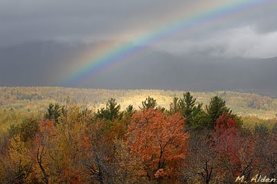
The rainbow above was a nice little gift for my efforts, even if the rainbow wasn't exactly "placed" where I would have liked it for a nicer composition, but oh well.
Alas, I didn't make it into Baxter thanks in part to heavy winds and rain, which forced me to change my itinerary. "The worse the weather, the better the pictures" is an old adage among outdoor photographers. I think this is more or less true.
The rainbow above was a nice little gift for my efforts, even if the rainbow wasn't exactly "placed" where I would have liked it for a nicer composition, but oh well.
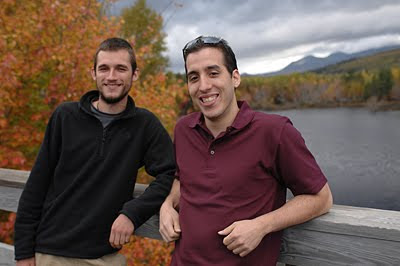
I met these two gentlemen while standing on the Abol Bridge outside of Millinocket, trying to catch a glimpse of Mt. Katahdin, which remained enshrouded in storm clouds for the remainder of the day.
The fellow on the left had just completed a through-hike of the AT (Appalachian Trail). An amazing accomplishment; it took him six months to complete the hike which begins in Georgia and ends at the summit of Katahdin. The AT is approximately 2,179 miles (or 3,506 km). The fellow on the right lives in NYC; he drove all the way up to Maine to pick up his frazzled friend.
I managed to hike several feet to my Toyota before driving approximately 100 miles to Bangor, mostly on a smooth interstate highway with a Thermos of hot coffee by my side. Such hardship.

No comments:
Post a Comment